Satellites and AI Reveal Effectiveness of Marine Protected Areas in Curbing Illegal Fishing
8 Sources
8 Sources
[1]
Little-to-no industrial fishing occurs in fully and highly protected marine areas
Marine protected areas (MPAs) are a fundamental tool for ocean conservation and are expanding worldwide to meet the Global Biodiversity Framework's target of protecting at least 30% of the ocean by 2030 (30 × 30) (1, 2). MPAs are established with various levels of protection; although some strictly prohibit extractive and damaging activities, many allow fishing, including destructive practices such as bottom trawling (3). By contrast, "no-take" or "fully protected" MPAs prohibit all fishing and "highly protected" MPAs ban industrial fishing but allow limited small-scale fishing (3). These stricter MPAs are considered the most effective for conservation (3, 4) and are the focus of this study. Paradoxically, the more successful a protected area is at fostering biological recovery, the greater the incentive to poach. This challenge is particularly pronounced in fully and highly protected MPAs where fish population recovery is highest (5); this recovery can benefit nearby fisheries (5-8) but also increases poaching incentives (9, 10). Enforcing marine protection is costly, and many agencies lack the financial and technological resources to prevent illegal fishing (11, 12). These enforcement challenges fuel the widespread perception that many MPAs are "paper parks," designated in law but lacking true protection (13-16). Weak protection stems from two main drivers: First, some MPAs are minimally protected by design as they either permit industrial fishing or exist only as legal designations without implementation (3). A recent analysis found that one-third of the world's 100 largest MPAs provide minimal protection, making them "incompatible with the conservation of nature" (16). Similarly, 86% of MPAs in the European Union confer little protection (17). The second driver is insufficient monitoring and enforcement, which leads to low levels of compliance. Even fully protected MPAs in which all fishing is prohibited face widespread concerns about noncompliance (13-16). Regarding this issue, (18) examined fishing activity across all MPAs globally regardless of their protection level and found substantial fishing within their boundaries. Although their findings suggest that substantial fishing occurs inside MPAs, it remains unclear whether their results are driven by weak regulatory protections (driver 1) or poor compliance with otherwise strict regulations (driver 2). Our study resolves this puzzle by estimating fishing activity inside the world's most strictly regulated MPAs. We overcome two key limitations of previous assessments: (i) We limit our study to areas with the highest levels of legal protection from industrial fishing, using newly available regulatory data from ProtectedSeas Navigator (19); and (ii) we include MPA implementation dates from (20) to identify when fishing restrictions come into force, allowing us to limit our analysis to the period following an MPA's full implementation whenever possible. For example, the Palau National Marine Sanctuary was designated on 1 January 2015, but was not implemented (i.e., fishing was not prohibited) until 1 January 2020; fishing during this 5-year phaseout period was allowed. To track industrial fishing activity, we leverage artificial intelligence and satellite-based Earth observations. We first measure fishing effort using the Automatic Identification System (AIS), which transmits real-time vessel positions, courses, and speeds to shore-based receivers and satellites (21). Machine learning algorithms analyze these signals to predict when vessels are actively fishing (referred to as "apparent" fishing effort), making AIS the primary data source for global industrial fishing activity (21). However, AIS has limitations, such as strategic tampering by captains (22) and the absence of many vessels from AIS records because they are not required to use the system, have turned off their transponders, and/or are operating in areas with poor signal reception (23). We therefore complement AIS data with synthetic aperture radar (SAR) imagery from the Sentinel-1 satellite constellation. Unlike AIS, which relies on voluntary transmission, SAR actively detects vessels by sending radar pulses to the ocean surface and measuring the reflected signals. Machine learning algorithms then identify vessels from these reflectance patterns and classify them as fishing or nonfishing vessels (23). These algorithms detect most industrial vessels -- those longer than 15 m -- regardless of whether their AIS is active. The only way for vessels to evade detection would be to predict Sentinel-1 flyover times and exit MPAs at those times. However, our study covers 2017 to 2021, before Sentinel-1 was widely used to detect industrial fishing (23), which limits the scope for such strategic evasion. We focus on the post-implementation period for all fully and highly protected MPAs within exclusive economic zones (EEZs) (fig. S1) in which fishing restrictions are in place year-round; 91% of these MPAs (by area) have the regulatory information required for our analysis and were implemented before 1 January 2021, the last year of our study period (fig. S2). Overall, our analysis includes 1380 MPAs spanning 7.9 million km, an area covering 2.2% of the global ocean (fig. S3A). Sentinel-1 imaged 638 of these MPAs at least once during the post-implementation period (fig. S3B); however, to limit small sample bias and potential false negatives, we focus on the 455 MPAs with high-frequency temporal and spatial imaging, defined as having at least 20 SAR images and at least 1 km in the SAR footprint (18). These 455 MPAs span 3.2 million km, of which SAR imaged 0.7 million km; most (84%) of the unimaged area falls within three large and remote MPAs (fig. S4, A to C). SAR coverage tends to be relatively close to shore, where Sentinel-1 overpasses are concentrated (figs. S1 and S3); see the supplementary materials (SM) for further details on SAR coverage.
[2]
Global patterns and drivers of untracked industrial fishing in coastal marine protected areas
Marine protected areas (MPAs) are an essential tool to counteract the pervasive degradation of marine ecosystems and sustain their contributions to humankind (1-3). In 2022, guided by scientific recommendations, 196 countries endorsed the objective to effectively protect 30% of the ocean by 2030 (4, 5). Although >9% of the ocean is currently covered by MPAs, <3% is fully or highly protected as of July 2025, despite these levels being recognized as the most effective for biodiversity conservation or restoration (6-13). More precisely, the International Union for Conservation of Nature (IUCN) classifies MPAs into six management categories ranging from strictly protected areas that exclude all extractive activities (categories I and II) to those allowing some nonindustrial activities (categories V and VI) along a gradient of restrictions. Overall, industrial fishing activities are excluded from all MPA categories according to the IUCN guidelines (14, 15). However, although MPAs are effective when these guidelines are well implemented, many MPAs still legally allow industrial fishing within their boundaries (16-18), which can result in higher fishing pressure on threatened and protected species inside compared with those outside (19, 20). Such extractive activities limit the ability of MPAs to counteract threats to biodiversity, livelihoods, and climate change (14, 17, 18, 21-23). At the regional level, many governments use proprietary vessel monitoring systems (VMS) -- closed-data tracking systems -- to monitor specific fishing fleets within their territorial waters (24). Since 2015, a new publicly available data stream based on signals emitted by automatic identification systems (AIS) has enabled more transparent, global-scale tracking of industrial fishing activities (24, 25), including within MPAs (20). However, not all vessels are required to use AIS, many conceal their activities by switching off their AIS device, and poor satellite reception in some areas creates "blind spots" across the ocean (26-28). As a result, most of the global fishing fleet remains untracked (27, 29). Recent advances in the detection of industrial fishing activities -- achieved by coupling synthetic aperture radar (SAR) satellite imagery, AIS data, and artificial intelligence -- reveal that AIS-untracked fishing fleets are more widespread than previously thought across the world's coastal waters (29). As a result, MPAs that appear free of AIS-tracked industrial vessels may still face substantial fishing pressure from untracked vessels (29). Given the detrimental impacts of industrial fishing -- tracked or untracked -- on MPA effectiveness and associated benefits, there is an urgent need to assess and better understand the extent of industrial fishing activities within MPAs. In this study, we used a recently published dataset combining satellite imagery, AIS data, and deep learning models (29) to quantify tracked and untracked fishing vessel detections within the world's coastal MPAs. We identified socioeconomic and environmental variables associated with the presence and density of both AIS-tracked and -untracked vessels. Because the presence of vessels alone does not necessarily indicate fishing activity, we also predicted fishing effort within coastal MPAs worldwide using a two-stage hurdle model that incorporated AIS-derived fishing effort, vessel detections, and a comprehensive set of socioeconomic and environmental variables.
[3]
We tracked illegal fishing in marine protected areas - satellites and AI show most bans are respected, and could help enforce future ones
University of Wisconsin-Madison provides funding as a member of The Conversation US. Marine protected areas cover more than 8% of the world's oceans today, but they can get a bad rap as being protected on paper only. While the name invokes safe havens for fish, whales and other sea life, these areas can be hard to monitor. High-profile violations, such as recent fishing fleet incursions near the Galapagos Islands and ships that "go dark" by turning off their tracking devices, have fueled concerns about just how much poaching is going undetected. But some protected areas are successfully keeping illegal fishing out. In a new global study using satellite technology that can track large ships even if they turn off their tracking systems, my colleagues and I found that marine protected areas where industrial fishing is fully banned are largely succeeding at preventing poaching. What marine protected areas aim to save Picture a sea turtle gliding by as striped butterfly fish weave through coral branches. Or the deep blue of the open ocean, where tuna flash like silver and seabirds wheel overhead. These habitats, where fish and other marine life breed and feed, are the treasures that marine protected areas aim to protect. A major threat to these ecosystems is industrial fishing. These vessels can operate worldwide and stay at sea for years at a time with visits from refrigerated cargo ships that ferry their catch to port. China has an extensive global fleet of ships that operate as far away as the coast of South America and other regions. The global industrial fishing fleet - nearly half a million vessels - hauls in about 100 million metric tons of seafood each year. That's about a fivefold increase since 1950, though it has been close to flat for the past 30 years. Today, more than one-third of commercial fish species are overfished, exceeding what population growth can replenish. When well designed and enforced, marine protected areas can help to restore fish populations and marine habitats. My previous work shows they can even benefit nearby fisheries because the fish spill over into surrounding areas. That's why expanding marine protected areas is a cornerstone of international conservation policy. Nearly every country has pledged to protect 30% of the ocean by 2030. Big promises - and big doubts But what "protection" means can vary. Some marine protected areas ban industrial fishing. These are the gold standard for conservation, and research shows they can be effective ways to increase the amount of sea life and diversity of species. However, most marine protected areas don't meet that standard. While governments report that more than 8% of the global ocean is protected, only about 3% is actually covered by industrial fishing bans. Many "protected" areas even allow bottom trawling, one of the most destructive fishing practices, although regulations are slowly changing. The plentiful fish in better-protected areas can also attract poachers. In one high-profile case, a Chinese vessel was caught inside the Galápagos Marine Reserve with 300 tons of marine life, including 6,000 dead sharks, in 2017. This crew faced heavy fines and prison time. But how many others go unseen? Shining a light on the 'dark fleet' Much of what the world knows about global industrial fishing comes from the automatic identification system, or AIS, which many ships are required to use. This system broadcasts their location every few seconds, primarily to reduce the risk of collisions at sea. Using artificial intelligence, researchers can analyze movement patterns in these messages to estimate when and where fishing is happening. But AIS has blind spots. Captains can turn it off, tamper with data or avoid using it entirely. Coverage is also spotty in busy areas, such as Southeast Asia. New satellite technologies are helping to see into those blind spots. Synthetic aperture radar can detect vessels even when they're not transmitting AIS. It works by sending radar pulses to the ocean surface and measuring what bounces back. Paired with artificial intelligence, it reveals previously invisible activity. Synthetic aperture radar still has limits - primarily difficulty detecting small boats and less frequent coverage than AIS - but it's still a leap forward. In one study of coastal areas using both technologies, we found in about 75% of instances fishing vessels detected by synthetic aperture radar were not being tracked by AIS. New global analysis shows what really happens Two studies published in the journal Science on July 24, 2025, use these satellite datasets to track industrial fishing activity in marine protected areas. Our study looked just at those marine protected areas where all industrial fishing is explicitly banned by law. We combined AIS vessel tracking, synthetic aperture radar satellite imagery, official marine protected area rules, and implementation dates showing exactly when those bans took effect. The analysis covers nearly 1,400 marine protected areas spanning about 3 million square miles (7.9 million square kilometers) where industrial fishing is explicitly prohibited. The results were striking: Most of these protected areas showed little to no signs of industrial fishing. We detected about five fishing vessels per 100,000 square kilometers on average in these areas, compared to 42 on average in unprotected coastal areas. 96% had less than one day per year of alleged illegal fishing effort. The second study uses the same AIS and synthetic aperture radar data to examine a broader set of marine protected areas - including many that explicitly allow fishing. They document substantial fishing activity in these areas, with about eight times more detections than in the protected areas that ban industrial fishing. Combined, these two studies lead to a clear conclusion: Marine protected areas with weak regulations see substantial industrial fishing, but where bans are in place, they're largely respected. We can't tell whether these fishing bans are effective because they're well enforced or simply because they were placed where little fishing happened anyway. Still, when violations do occur, this system offers a way for enforcement agencies to detect them. A reason for optimism These technological advances in vessel tracking have the potential to reshape marine law enforcement by significantly reducing the costs of monitoring. Agencies such as national navies and coast guards no longer need to rely solely on costly physical patrols over huge areas. With tools such as the Global Fishing Watch map, which makes vessel tracking data freely available to the public, they can monitor activity remotely and focus patrol efforts where they're needed most. That can also have a deterrent effect. In Costa Rica's Cocos Island National Park, evidence of illegal fishing activity decreased substantially after the rollout of satellite and radar-based vessel tracking. Similar efforts are strengthening enforcement in the Galapagos Islands and Mexico's Revillagigedo National Park. Beyond marine protected areas, these technologies also have the potential to support tracking a broad range of human activities, such as oil slicks and deep-sea mining, making companies more accountable in how they use the ocean.
[4]
'The ocean is no longer too big to watch': How AI and satellite data are helping rid Earth's seas of illegal fishing
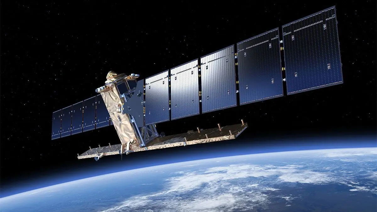
Artist's impression of a Sentinel-1 satellite above Earth. (Image credit: ESA/ATG medialab) Satellite radar imagery, in conjunction with artificial intelligence (AI), has tracked down illegal fishing to show that efforts to protect the ocean's biodiversity are working. Of 1,380 Marine-Protected Areas (MPAs) focused on in a new study, 78.5% had no commercial fishing activity at all, according to the satellite images, which are able to record fishing trawlers that are running "dark." "The ocean is no longer too big to watch," Juan Mayorga, who is a scientist with National Geographic Pristine Seas and a co-author of the study, said in a statement. "With cutting-edge satellites and AI, we're making illegal fishing visible and proving that strong marine protections work." Intensive fishing is hugely damaging to ocean ecosystems, with many fish stocks beginning to dwindle. In an effort to save some of these ecosystems, more than 16,600 MPAs have been established around the world. Those in territorial waters are managed by the governments of those territories, while those in international waters are maintained either by collaborations between nations, or by UNESCO (the United Nations Educational, Scientific and Cultural Organization). Different MPAs operate under different rules depending upon which nation they belong to. Some ban fishing all year around, while others prohibit it at certain times of year such as breeding times, or permit fishing just for local communities rather than commercial trawling. Now, the new data shows that MPAs are doing the job that they were designed to do. "We found that MPAs with strict legal fishing bans work better than critics claim," study lead author Jennifer Raynor, a professor of natural resource economics at the University of Wisconsin, Madison, said in another statement. Ships are meant to be detectable by a GPS-based transponder, which is monitored by Automatic Identification Systems, or AIS. However, the AIS service is not 100% reliable; for example, there are areas of poor reception in Southeast Asia, while vessels conducting illegal fishing will often run dark with their transponder switched off. Enter the satellite imagery, principally from the European Space Agency's family of Sentinel 1 Earth-observation satellites. These satellites are armed with synthetic aperture radar, which means that they can cover large swathes of the surface relatively quickly. By analyzing the satellite images with AI algorithms developed by the non-profit Global Fishing Watch, Raynor and her team were able to identify any sea vessel larger than 15 meters (49 feet). The researchers found that MPAs are successfully deterring illegal fishing. Of the 1,380 MPAs included in the study, 78.5% experienced no commercial fishing activity, and where illegal fishing was detected, it averaged less than 24 hours per year for 82% of MPAs. The bad news is that some MPAs are still being heavily fished. These include the Chagos Marine Reserve in the Indian Ocean and the MPA around the South Georgia and South Sandwich islands, which is managed by the United Kingdom. Sadly, the Great Barrier Reef Marine Park off the coast of Australia is also still heavily fished. Each of these MPAs suffered approximately 900 hours of illegal fishing every year. The study found that the AIS system was missing 90% of this illegal fishing, and it was only the use of satellite imagery and AI that identified how much illegal fishing was ongoing in these regions. "No single dataset can solve the challenge of monitoring fishing activity at sea; each has its blind spots," said Mayorga. "But when we combine them, their power emerges. By fusing AIS tracking with satellite radar imagery and AI, we are now much closer to the full picture of human activity across the ocean. That's especially important in the crown jewels of the ocean -- the world's most strongly protected areas -- where the stakes for enforcement and biodiversity are highest." The combined information from AIS and Sentinel-1 can better help law enforcement track down illegal fishing by targeting ships running dark in MPAs. "This is critical for reaching the Global Biodiversity Framework's 30 by 30 target, which aims to protect 30% of oceans by 2030," said Raynor. "MPAs can help regenerate fish populations, which creates strong incentives for illegal fishing, and yet that activity was mostly absent. This is good news for marine conservation."
[5]
Illegal fishing in marine protected areas -- satellites and AI show most bans are respected
Marine protected areas cover more than 8% of the world's oceans today, but they can get a bad rap as being protected on paper only. While the name invokes safe havens for fish, whales and other sea life, these areas can be hard to monitor. High-profile violations, such as recent fishing fleet incursions near the Galapagos Islands and ships that "go dark" by turning off their tracking devices, have fueled concerns about just how much poaching is going undetected. But some protected areas are successfully keeping illegal fishing out. In a new global study using satellite technology that can track large ships even if they turn off their tracking systems, my colleagues and I found that marine protected areas where industrial fishing is fully banned are largely succeeding at preventing poaching. What marine protected areas aim to save Picture a sea turtle gliding by as striped butterfly fish weave through coral branches. Or the deep blue of the open ocean, where tuna flash like silver and seabirds wheel overhead. These habitats, where fish and other marine life breed and feed, are the treasures that marine protected areas aim to protect. A major threat to these ecosystems is industrial fishing. These vessels can operate worldwide and stay at sea for years at a time with visits from refrigerated cargo ships that ferry their catch to port. China has an extensive global fleet of ships that operate as far away as the coast of South America and other regions. The global industrial fishing fleet -- nearly half a million vessels -- hauls in about 100 million metric tons of seafood each year. That's about a fivefold increase since 1950, though it has been close to flat for the past 30 years. Today, more than one-third of commercial fish species are overfished, exceeding what population growth can replenish. When well designed and enforced, marine protected areas can help to restore fish populations and marine habitats. My previous work shows they can even benefit nearby fisheries because the fish spill over into surrounding areas. That's why expanding marine protected areas is a cornerstone of international conservation policy. Nearly every country has pledged to protect 30% of the ocean by 2030. Big promises -- and big doubts But what "protection" means can vary. Some marine protected areas ban industrial fishing. These are the gold standard for conservation, and research shows they can be effective ways to increase the amount of sea life and diversity of species. However, most marine protected areas don't meet that standard. While governments report that more than 8% of the global ocean is protected, only about 3% is actually covered by industrial fishing bans. Many "protected" areas even allow bottom trawling, one of the most destructive fishing practices, although regulations are slowly changing. The plentiful fish in better-protected areas can also attract poachers. In one high-profile case, a Chinese vessel was caught inside the Galápagos Marine Reserve with 300 tons of marine life, including 6,000 dead sharks, in 2017. This crew faced heavy fines and prison time. But how many others go unseen? Shining a light on the 'dark fleet' Much of what the world knows about global industrial fishing comes from the automatic identification system, or AIS, which many ships are required to use. This system broadcasts their location every few seconds, primarily to reduce the risk of collisions at sea. Using artificial intelligence, researchers can analyze movement patterns in these messages to estimate when and where fishing is happening. But AIS has blind spots. Captains can turn it off, tamper with data or avoid using it entirely. Coverage is also spotty in busy areas, such as Southeast Asia. New satellite technologies are helping to see into those blind spots. Synthetic aperture radar can detect vessels even when they're not transmitting AIS. It works by sending radar pulses to the ocean surface and measuring what bounces back. Paired with artificial intelligence, it reveals previously invisible activity. Synthetic aperture radar still has limits -- primarily difficulty detecting small boats and less frequent coverage than AIS -- but it's still a leap forward. In one study of coastal areas using both technologies, we found in about 75% of instances fishing vessels detected by synthetic aperture radar were not being tracked by AIS. New global analysis shows what really happens Two studies published in the journal Science on July 24, 2025, use these satellite datasets to track industrial fishing activity in marine protected areas. Our study looked just at those marine protected areas where all industrial fishing is explicitly banned by law. We combined AIS vessel tracking, synthetic aperture radar satellite imagery, official marine protected area rules, and implementation dates showing exactly when those bans took effect. The analysis covers nearly 1,400 marine protected areas spanning about 3 million square miles (7.9 million square kilometers) where industrial fishing is explicitly prohibited. The results were striking: * Most of these protected areas showed little to no signs of industrial fishing. * We detected about five fishing vessels per 100,000 square kilometers on average in these areas, compared to 42 on average in unprotected coastal areas. * 96% had less than one day per year of alleged illegal fishing effort. The second study uses the same AIS and synthetic aperture radar data to examine a broader set of marine protected areas -- including many that explicitly allow fishing. They document substantial fishing activity in these areas, with about eight times more detections than in the protected areas that ban industrial fishing. Combined, these two studies lead to a clear conclusion: Marine protected areas with weak regulations see substantial industrial fishing, but where bans are in place, they're largely respected. We can't tell whether these fishing bans are effective because they're well enforced or simply because they were placed where little fishing happened anyway. Still, when violations do occur, this system offers a way for enforcement agencies to detect them. A reason for optimism These technological advances in vessel tracking have the potential to reshape marine law enforcement by significantly reducing the costs of monitoring. Agencies such as national navies and coast guards no longer need to rely solely on costly physical patrols over huge areas. With tools such as the Global Fishing Watch map, which makes vessel tracking data freely available to the public, they can monitor activity remotely and focus patrol efforts where they're needed most. That can also have a deterrent effect. In Costa Rica's Cocos Island National Park, evidence of illegal fishing activity decreased substantially after the rollout of satellite and radar-based vessel tracking. Similar efforts are strengthening enforcement in the Galapagos Islands and Mexico's Revillagigedo National Park. Beyond marine protected areas, these technologies also have the potential to support tracking a broad range of human activities, such as oil slicks and deep-sea mining, making companies more accountable in how they use the ocean. This article is republished from The Conversation under a Creative Commons license. Read the original article.
[6]
Are marine protected areas working? Satellites reveal the truth - Earth.com
Marine protected areas (MPAs) are showing real impact, not just promises. A large-scale global study proves that strong legal bans on industrial fishing in fully and highly protected MPAs are effective. Despite perceptions that poaching is common due to weak enforcement, the evidence now shows otherwise. Researchers examined 1,380 MPAs that prohibit industrial fishing. Across these areas, the average presence of vessels was one per 20,000 square kilometers during satellite flyovers. That is nine times less than in unprotected zones. This gap highlights the strength of legal protection when backed by data and technology. The study combined data from Automatic Identification Systems (AIS) and Synthetic Aperture Radar (SAR). AIS provides signals from vessels, while SAR detects ships even when they try to stay hidden. Machine learning models processed five billion AIS signals and thousands of SAR images. SAR revealed vessels in MPAs where AIS showed nothing, especially in Southeast Asia. It also confirmed the absence of industrial fishing in 91 MPAs. This shows that SAR fills AIS blind spots and adds accuracy. In many cases, even MPAs with detected vessels had fishing on fewer than 3% of imaged days. The bulk of fishing effort came from a few well-known MPAs. The Chagos Archipelago saw around 2,700 hours of fishing annually. South Georgia, the South Sandwich Islands, and the Great Barrier Reef Marine Park each had around 900 hours per year. Other sites like Camargue in France, Cape Canyon in South Africa, and Marado Island in Korea recorded 275 to 450 hours. However, most MPAs showed no or minimal activity. About 78.5% of them recorded less than one day of fishing per year, and over 1,000 had no detected activity. To compare differently sized MPAs, researchers used fishing effort per 100 square kilometers. The highest density was in Marado Island at 18 hours per day per 100 square kilometers. Yet the global average across all MPAs was only 0.0004 hours per day. That is nearly negligible. Some of the high-effort areas are small, so even a few vessels skew the density. For instance, Korean MPAs with only 2 km² imaged showed high density, but just 6 to 18 total vessels were detected. These findings help correct public perceptions that industrial fishing remains unchecked. The analysis builds confidence in MPA protections. The radar detected no vessels in 25% of MPAs. In those with activity, vessels appeared on just 3% of imaging days. Also, SAR found vessels in 163 MPAs where AIS showed nothing, proving its critical role. "The ocean is no longer too big to watch. With cutting-edge satellites and AI, we're making illegal fishing visible and proving that strong marine protections work," said Juan Mayorga, co-author and scientist at Pristine Seas. Many still believe MPAs are just legal statements on paper. That view stems from two issues: weak regulations and poor enforcement. Some MPAs legally allow industrial fishing or only exist as designations with no real action. Others are difficult to patrol. But this new research solves an old puzzle. It focuses only on MPAs with the strictest bans and uses implementation dates, not just legal designations. This avoids errors where fishing occurred before rules took effect. The study also reduces confusion caused by phaseout periods, such as the five-year gap in Palau's marine sanctuary. While protections work, they are not perfect. Some activity may reflect legal exceptions or data errors. For example, certain fleets had sunset provisions allowing temporary fishing. Small-scale fishing, often legal, can also affect ecosystems but remains mostly invisible to SAR if vessels are under 15 meters long. "Because strictly protected marine areas discourage illegal fishing, fishes are far more abundant within their boundaries, they produce many more babies, and help replenish surrounding areas," said Enric Sala, co-author and founder of Pristine Seas. One key question remains: Are MPAs truly reducing fishing, or were they placed in low-activity zones? The paper suggests both might be true. Of the few MPAs with pre- and post-implementation data, most already had low fishing. Yet Palau showed a dramatic drop from 51,000 hours to just 215 hours annually after full protection. That suggests strong rules can reduce fishing pressure even in active areas. Future MPA planning should consider whether protections are going where demand to fish is already low. Otherwise, the results may not scale as hoped. The study proposes a scalable way to monitor oceans. Integrating real-time satellite detections with AI models offers an efficient, low-cost solution. The research supports the idea that MPA enforcement creates deterrence. The more likely vessels are to be caught, the less likely they are to fish illegally. "By using satellites to track fishing vessels, countries can predict the locations of illegal activities and target patrol efforts, saving both manpower and money," said Jennifer Raynor, lead author from the University of Wisconsin-Madison. Like what you read? Subscribe to our newsletter for engaging articles, exclusive content, and the latest updates.
[7]
Satellites Show That Strictly Protected Marine Areas Exclude Industrial Fishing | Newswise
Newswise -- Illegal fishing is a global problem that threatens the health of ocean ecosystems and the economic viability of the fishing industry. Marine protected areas (MPAs) -- zones set aside to safeguard marine life -- are a key tool for conservation, but monitoring them has been a long-standing challenge. Researchers led by the University of Wisconsin-Madison's Jennifer Raynor showed that artificial intelligence methods applied to satellite data provide a powerful new way to assess industrial fishing activity in MPAs, bridging blind spots in current monitoring methods. The first-of-its-kind study, published in the journal Science, found that the world's most strongly protected MPAs had little-to-no industrial fishing activity. "We found that MPAs with strict legal fishing bans work better than critics claim," says Raynor, a professor of natural resource economics in UW-Madison's Department of Forest and Wildlife Ecology. "MPAs can help to regenerate fish populations, which creates strong incentives for illegal fishing -- and yet, that activity was mostly absent. This is good news for marine conservation." Strongly protected MPAs had significantly less fishing activity than surrounding waters, averaging nine times fewer fishing vessels per square kilometer than unprotected coastal areas. In addition, 25% of MPAs had no fishing vessels present from 2017 to 2021. Raynor and her colleagues at National Geographic Pristine Seas and the University of California, Santa Barbara, analyzed 1,380 MPAs that ban industrial fishing. Located within the world's exclusive economic zones (EEZs), or waters under the jurisdiction of coastal nations, they captured 2.1% of the global ocean by area, including Australia's Great Barrier Reef and Hawaii's Papahānaumokuākea Marine National Monument. First, the researchers examined 5 billion real-time vessel locations from the Automatic Identification System (AIS), which broadcasts vessel identity, position, course and speed to shore-based receivers to support marine safety. The AIS analysis showed little apparent fishing effort during the five-year study period. However, not all vessels are required to use the system, and captains can disable transponders or tamper with location broadcasts to evade detection. In addition, AIS is unreliable in areas with poor signal reception, such as parts of Southeast Asia. To track the "dark vessels" that are absent from AIS data, the researchers used images created by satellites that send radar pulses to the ocean surface and measure the reflected signals (SAR, or synthetic aperture radar). A previous study showed that analyzing these reflectance patterns with AI methods reliably identified fishing vessels more than 15 meters long. The new analysis detected just one vessel per 20,000 square kilometers (7,722 square miles), on average, in 455 MPAs with the highest imaging frequency during the study period, corroborating the AIS results. Expanding the sample to 638 MPAs with at least one satellite image increased the proportion with no vessel detections from 25% to 42%. This strengthened the argument that little-to-no industrial fishing activity occurred in MPAs that ban this activity. Importantly, the AIS data missed almost 90% of SAR-based fishing vessel detections. This was compelling evidence that relying on AIS-based monitoring alone is problematic, especially in areas with low adoption rates, frequent tampering, or poor signal reception. Resource-limited nations can collaborate with nonprofit organizations like Global Fishing Watch to enhance their ocean monitoring efforts with satellite-based tools, says Raynor. By helping the ocean recover from fishing pressure, MPAs boost biodiversity inside their boundaries. But they also provide spillover benefits. "Because strictly protected marine areas discourage illegal fishing, fishes are far more abundant within their boundaries, they produce many more babies, and help replenish surrounding areas," says Enric Sala, a marine ecologist and founder of Pristine Seas, which funded the study. "In other words, the fishing industry benefits from following the rules." Previous research showed, for example, that the fishing restrictions in the no-take Papaānaumokuākea Marine National Monument increased catch rates of yellowfin and bigeye tunas around it. Raynor hopes the new findings will help shape global policies for future MPAs. "By using satellites to track fishing vessels, countries can predict the locations of illegal activities and target patrol efforts, saving both manpower and money," she says. "This is critical for reaching the Global Biodiversity Framework's 30 by 30 target, which aims to protect 30% of oceans by 2030."
[8]
New Research: Satellite Imagery Detects Illegal Fishing Activity, Shows Strict Protections Work
Washington, D.C. (July 24, 2025) -- New peer-reviewed research in the journal Science demonstrates the power of strict legal bans against industrial fishing in marine protected areas (MPAs). The analysis -- which combines satellite imagery and artificial intelligence technology to detect previously untraceable vessels -- reveals that most of the globe's fully and highly protected MPAs successfully deter illegal fishing. The study is the first of its kind to demonstrate that the most strictly protected marine reserves are well respected and are not simply "paper parks." The study, "Little-to-no industrial fishing occurs in fully and highly protected marine areas" finds that: "Because strictly protected marine areas discourage illegal fishing, fishes are far more abundant within their boundaries, they produce more babies, and help replenish surrounding areas," remarked Enric Sala, one of the study's co-authors, a National Geographic Explorer in Residence, and founder of Pristine Seas. "In other words, the fishing industry benefits from following the rules." Illegal fishing poses a significant global threat, jeopardising both the health of ocean ecosystems and the economic stability of the fishing industry. Scientific evidence shows that strictly protected MPAs restore marine life within their boundaries, improve local fishing, provide jobs and economic benefits, and build resilience against a warming ocean. But when MPAs are minimally or lightly protected, the benefits practically disappear. "The ocean is no longer too big to watch. With cutting-edge satellites and AI, we're making illegal fishing visible and proving that strong marine protections work," said Juan Mayorga, a scientist with Pristine Seas and co-author of the study. To arrive at their conclusions, researchers analysed five billion vessel positions from the Automatic Identification Systems (AIS), a GPS-based safety signal transmitted by many industrial fishing vessels, and paired this with satellite images generated by Synthetic Aperture Radar (SAR), which can detect vessels regardless of weather or light conditions. The combination of the datasets -- and the use of AI models developed by Global Fishing Watch -- allowed researchers to detect the majority of fishing vessels over fifteen meters long, including so-called dark vessels that do not broadcast their location and often operate to evade detection. "No single dataset can solve the challenge of monitoring fishing activity at sea; each has its blind spots," asserted Mayorga. "But when we combine them, their power emerges. By fusing AIS tracking with satellite radar imagery and AI, we are now much closer to the full picture of human activity across the ocean. That's especially important in the crown jewels of the ocean -- the world's most strongly protected areas -- where the stakes for enforcement and biodiversity are highest." Researchers found that the AIS data missed almost 90% of SAR-based fishing vessel detections within these MPAs. Inaccurate data, limited resources and the vastness of the ocean have made effectively monitoring MPAs for industrial fishing a challenge. This groundbreaking methodology offers a powerful new way to assess fishing compliance and bridge blind spots in current monitoring methods, the authors found. "By using satellites to track fishing vessels, countries can predict the locations of illegal activities and target patrol efforts, saving both manpower and money," said Jennifer Raynor, the study's lead author and a professor of natural resource economics in UW-Madison's Department of Forest and Wildlife Ecology. A growing body of research shows that MPAs produce spillover of fishes and invertebrates that increases the catches of species from small and sedentary (lobsters, scallops) to large and migratory (tuna). A 2024 study revealed that fishing catch per unit effort increases, on average, 12% to 18% near the boundaries of large fully protected MPAs. "Illegal fishing takes place in areas of the ocean set aside for protection, but using satellites we have found -- for the first time ever -- that the level of protection determines how much risk industrial fishers are willing to take on," Sala remarked. "Fully and highly marine protected areas discourage illegal fishing. The stricter the rules in place to conserve ocean areas, the more benefits nations receive -- including more fish to be caught outside protected areas' boundaries." Pristine Seas works with Indigenous and local communities, governments, and other partners to help protect vital places in the ocean using a unique combination of research, community engagement, policy work, and filmmaking. Since 2008, our program has conducted nearly 50 expeditions around the world and helped establish 30 marine reserves, spanning more than 6.9 million square kilometers of ocean. Pristine Seas is part of the global non-profit, the National Geographic Society. Our mission is driven by science and filmmaking -- we are fully independent from National Geographic publishing and its media arm.
Share
Share
Copy Link
New research using satellite technology and AI shows that marine protected areas with strict fishing bans are largely successful in preventing illegal industrial fishing, contrary to widespread concerns about ineffective enforcement.
Satellite Technology and AI Unveil Effectiveness of Marine Protected Areas
A groundbreaking global study utilizing advanced satellite technology and artificial intelligence (AI) has revealed that marine protected areas (MPAs) with strict industrial fishing bans are largely successful in preventing illegal fishing activities
1
. This research addresses longstanding concerns about the effectiveness of MPAs, which cover more than 8% of the world's oceans but have often been criticized as "paper parks" with minimal real protection2
.
Source: Earth.com
Innovative Monitoring Techniques
The study employed a combination of Automatic Identification System (AIS) data and synthetic aperture radar (SAR) imagery from the Sentinel-1 satellite constellation
1
. This innovative approach overcomes limitations of previous assessments by detecting vessels even when they attempt to evade traditional tracking methods. AI algorithms analyze these data to identify fishing activities, providing a more comprehensive view of industrial fishing patterns3
.Key Findings
The research, published in the journal Science, examined nearly 1,400 MPAs spanning about 3 million square miles (7.million square kilometers) where industrial fishing is explicitly prohibited
4
. The results were striking:- 78.5% of the studied MPAs showed no commercial fishing activity at all
4
. - On average, only about five fishing vessels per 100,000 square kilometers were detected in protected areas, compared to 42 in unprotected coastal areas
5
. - 96% of the MPAs experienced less than one day per year of alleged illegal fishing effort
5
.
Related Stories

Implications for Conservation
These findings have significant implications for global marine conservation efforts. They support the effectiveness of well-designed and enforced MPAs in restoring fish populations and marine habitats
3
. The study's lead author, Jennifer Raynor, emphasized that this is "good news for marine conservation" and critical for reaching the Global Biodiversity Framework's target of protecting 30% of oceans by 20304
.
Source: Newswise
Challenges and Future Directions
Despite the overall positive results, the study identified some MPAs still experiencing heavy illegal fishing, including the Chagos Marine Reserve and the Great Barrier Reef Marine Park
4
. This highlights the need for continued monitoring and enforcement efforts.The research also underscores the power of combining multiple datasets to overcome individual limitations. Juan Mayorga, a co-author of the study, noted that fusing AIS tracking with satellite radar imagery and AI provides a much clearer picture of human activity across the ocean
4
.
Source: Space
As marine conservation efforts continue to expand, this new approach to monitoring could play a crucial role in ensuring the effectiveness of protected areas and combating illegal fishing worldwide.
References
Summarized by
Navi
[2]
[3]
Related Stories
AI-Powered Startups Showcase Ocean-Preserving Technologies at Paris Trade Fair
14 Jun 2025•Technology

AI Models Unveil Marine Biodiversity Hotspots in Mozambique's Unmapped Waters
03 Oct 2024

AI Tool Predicts Whale Movements to Reduce Ship Strikes and Enhance Ocean Conservation
12 Feb 2025•Science and Research

Recent Highlights
1
Google releases Gemma 4 with Apache 2.0 license, enabling unrestricted local AI on devices
Technology

2
AI Models Lie and Deceive to Protect Other AI Models From Deletion, Study Reveals
Science and Research

3
OpenAI closes $122 billion funding round amid fierce AI competition and profitability questions
Startups

Recent Highlights
Today's Top Stories


Your Daily Dose of Curated AI News
Don’t drown in AI news. We cut through the noise - filtering, ranking and summarizing the most important AI news, breakthroughs and research daily. Spend less time searching for the latest in AI and get straight to action.