Essential Apps and Websites for Hurricane Preparedness and Tracking
2 Sources
2 Sources
[1]
I've weathered a lot of hurricanes - these 8 apps and websites are my must-have storm tools
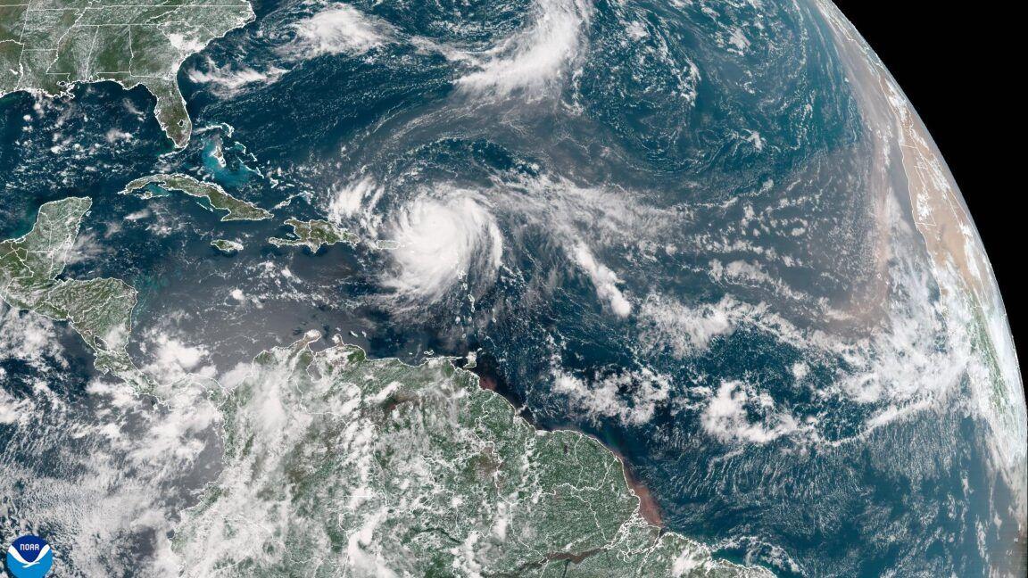
Living in South Florida means that hurricanes are a regular part of my life. Through experience, I've learned that preparing for a storm is more than just stocking up on supplies -- it's also about having the right data and tools available. As a technology professional who's weathered multiple hurricanes since moving to the state in 2012, I've become passionate about tracking storms. I make it a point to stay 7 to 10 days ahead, closely monitoring every model and update as a storm develops and strengthens. Also: The best VPN services: Expert tested and reviewed Here's an overview of the apps and websites that I rely on to stay ahead of the storms. I always start with the official source: the NOAA National Hurricane Center. Although the site's design may look straight out of the 1990s, the NOAA remains the definitive resource for tracking storm paths, wind speeds, and projections. Professionals, government agencies, and even other websites use NOAA data to build their forecasts. The University of Wisconsin's Space Science and Engineering Center (SSEC) and the National Environmental Satellite, Data, and Information Service's (NESDIS) STAR GOES Imagery are two sites I consider invaluable for anyone wanting detailed satellite imagery and in-depth storm tracking data. Though their designs are outdated, these sites offer professional-grade hurricane data crucial during an active storm. Also: The best AI image generators: Tested and reviewed I'm a big fan of Mike's Weather Page, which has become my go-to for approachable, real-time storm updates. Via his website and YouTube podcast, Mike Boylan distills complex storm data into easy-to-understand live streams and posts, making it accessible to everyone. Tropical Tidbits, a go-to resource for storm trackers, was created by meteorologist Levi Cowan in 2012. Originally a hurricane forecasting blog, the site has since evolved into a powerful tool for real-time data visualizations used by scientists and weather enthusiasts alike. Levi, who holds a Ph.D. in meteorology and is a certified tropical cyclone forecaster at the Joint Typhoon Warning Center, also hosts a popular YouTube podcast that reviews current storm models and discusses tropical weather developments. Radarscope (iOS, Android) is hands down the best app for real-time radar tracking. Whether you're a serious weather enthusiast or a professional meteorologist, Radarscope gives you high-definition Doppler radar data in real-time. It's a must-have during storm season. Subscription: The base app (iOS, Android) is $9.99, but I subscribe to Pro Tier 1 ($9.99/year) for real-time lightning data and extended radar loops. Pro Tier 2 ($14.99/year) adds dual-polarization radar and access to archived radar data, which I use to review past storm events. MyRadar (iOS, Android) is one of the most popular weather apps, and for good reason. It's fast, easy to use, and packed with features for tracking storms and other severe weather. Whether you need a quick overview or detailed storm tracking, MyRadar has you covered. Windy is one of the most comprehensive weather apps (iOS,Android) and websites, offering various weather forecasting models and tools. It integrates global models like ECMWF, GFS, and ICON and local models for regions like the US, Europe, and Australia. The app provides 51 weather maps -- including wind, rain, temperature, pressure, swell, and CAPE index maps -- giving you detailed insights into weather conditions worldwide. Windy also features global satellite composites from NOAA, EUMETSAT, and Himawari, and a Radar+ layer for real-time storm and precipitation tracking. Users can add points of interest such as weather stations, airports, and webcams, making it highly versatile for both casual users and professionals. Customization is a key strength -- users can adjust color palettes, save favorite maps to a quick menu, and access advanced settings. For those who need more detailed data, the premium subscription ($18.99/year) offers a one-hour forecast step, a 10-day forecast outlook, and frequent forecast updates. The free FEMA App (iOS, Android) is a must-have for anyone living in hurricane-prone areas. It provides real-time alerts and emergency preparedness information, helping you stay informed before, during, and after a storm. Also: The Weather Channel's new AI tool will help generate forecasts for your local news Why these tools? I depend on these apps and websites because they provide a comprehensive view of storm tracking. From real-time radar to predictive models, each tool offers something unique. As someone who's been through my share of hurricanes, I know how crucial it is to have reliable data and visuals at your fingertips. With storms becoming more unpredictable, having multiple sources of information helps me make better decisions about whether to stay or evacuate.
[2]
I've weathered a lot of hurricanes - these are my must-have storm tracking tools
Living in South Florida means that hurricanes are a regular part of my life. Through experience, I've learned that preparing for a storm is more than just stocking up on supplies -- it's also about having the right data and tools available. As a technology professional who's weathered multiple hurricanes since moving to the state in 2012, I've become passionate about tracking storms. I make it a point to stay 7 to 10 days ahead, closely monitoring every model and update as a storm develops and strengthens. Also: The best VPN services: Expert tested and reviewed Here's an overview of the apps and websites that I rely on to stay ahead of the storms. I always start with the official source: the NOAA National Hurricane Center. Although the site's design may look straight out of the 1990s, the NOAA remains the definitive resource for tracking storm paths, wind speeds, and projections. Professionals, government agencies, and even other websites use NOAA data to build their forecasts. The University of Wisconsin's Space Science and Engineering Center (SSEC) and the National Environmental Satellite, Data, and Information Service's (NESDIS) STAR GOES Imagery are two sites I consider invaluable for anyone wanting detailed satellite imagery and in-depth storm tracking data. Though their designs are outdated, these sites offer professional-grade hurricane data crucial during an active storm. Also: The best AI image generators: Tested and reviewed I'm a big fan of Mike's Weather Page, which has become my go-to for approachable, real-time storm updates. Via his website and YouTube podcast, Mike Boylan distills complex storm data into easy-to-understand live streams and posts, making it accessible to everyone. Tropical Tidbits, a go-to resource for storm trackers, was created by meteorologist Levi Cowan in 2012. Originally a hurricane forecasting blog, the site has since evolved into a powerful tool for real-time data visualizations used by scientists and weather enthusiasts alike. Levi, who holds a Ph.D. in meteorology and is a certified tropical cyclone forecaster at the Joint Typhoon Warning Center, also hosts a popular YouTube podcast that reviews current storm models and discusses tropical weather developments. Radarscope (iOS, Android) is hands down the best app for real-time radar tracking. Whether you're a serious weather enthusiast or a professional meteorologist, Radarscope gives you high-definition Doppler radar data in real-time. It's a must-have during storm season. Subscription: The base app (iOS, Android) is $9.99, but I subscribe to Pro Tier 1 ($9.99/year) for real-time lightning data and extended radar loops. Pro Tier 2 ($14.99/year) adds dual-polarization radar and access to archived radar data, which I use to review past storm events. MyRadar (iOS, Android) is one of the most popular weather apps, and for good reason. It's fast, easy to use, and packed with features for tracking storms and other severe weather. Whether you need a quick overview or detailed storm tracking, MyRadar has you covered. Windy is one of the most comprehensive weather apps (iOS,Android) and websites, offering various weather forecasting models and tools. It integrates global models like ECMWF, GFS, and ICON and local models for regions like the US, Europe, and Australia. The app provides 51 weather maps -- including wind, rain, temperature, pressure, swell, and CAPE index maps -- giving you detailed insights into weather conditions worldwide. Windy also features global satellite composites from NOAA, EUMETSAT, and Himawari, and a Radar+ layer for real-time storm and precipitation tracking. Users can add points of interest such as weather stations, airports, and webcams, making it highly versatile for both casual users and professionals. Customization is a key strength -- users can adjust color palettes, save favorite maps to a quick menu, and access advanced settings. For those who need more detailed data, the premium subscription ($18.99/year) offers a one-hour forecast step, a 10-day forecast outlook, and frequent forecast updates. The free FEMA App (iOS, Android) is a must-have for anyone living in hurricane-prone areas. It provides real-time alerts and emergency preparedness information, helping you stay informed before, during, and after a storm. Also: The Weather Channel's new AI tool will help generate forecasts for your local news Why these tools? I depend on these apps and websites because they provide a comprehensive view of storm tracking. From real-time radar to predictive models, each tool offers something unique. As someone who's been through my share of hurricanes, I know how crucial it is to have reliable data and visuals at your fingertips. With storms becoming more unpredictable, having multiple sources of information helps me make better decisions about whether to stay or evacuate.
Share
Share
Copy Link
A comprehensive guide to the most useful digital tools for hurricane preparedness and tracking, based on personal experience and expert recommendations.

The Importance of Digital Tools in Hurricane Preparedness
As hurricane season approaches, having the right digital tools at your fingertips can make a significant difference in staying informed and prepared. With years of experience weathering hurricanes, tech experts have compiled a list of essential apps and websites that serve as invaluable resources during these natural disasters
1
.Top Hurricane Tracking Apps
One of the most crucial tools for hurricane preparedness is a reliable tracking app. The National Hurricane Center's website and app are considered the gold standard for hurricane information
2
. However, other apps like Windy, RadarScope, and MyRadar also offer valuable features such as real-time wind data, detailed radar information, and customizable alerts.Essential Weather Information Sources
In addition to tracking apps, staying updated with accurate weather information is vital. The Weather Channel app provides comprehensive forecasts and severe weather alerts. For those seeking more detailed data, Recon Weather offers in-depth analysis of tropical systems, including data from hurricane hunter aircraft
1
.Power Outage Tracking and Preparation
Power outages are a common consequence of hurricanes. Apps like PowerOutage.us help users track outages in their area, while GasBuddy assists in locating operational gas stations during emergencies
1
. These tools can be crucial for planning evacuation routes or understanding the extent of storm damage.Emergency Communication and Safety Apps
Maintaining communication during a hurricane is essential for safety. The American Red Cross Hurricane app offers features like emergency alerts, shelter locations, and first aid information
1
. Additionally, apps like Zello, which turns your phone into a walkie-talkie, can be invaluable when cellular networks are down.Related Stories

Local Government and Utility Resources
Many local governments and utility companies now offer their own apps or websites with storm-specific information. These can provide hyper-local updates on evacuations, power restoration efforts, and emergency services
2
. It's recommended to download these apps before a storm hits, as they can be difficult to access during the event.Preparation and Recovery Tools
Apps like ICE (In Case of Emergency) Medical Standard allow users to store important medical information that first responders can access in emergencies
1
. For the recovery phase, FEMA's app provides information on applying for disaster assistance and locating recovery centers.By leveraging these digital tools, individuals can enhance their preparedness and response to hurricanes. However, it's important to remember that while these apps and websites are valuable resources, they should be used in conjunction with official guidance from local authorities and emergency management agencies.
References
Summarized by
Navi
[1]
Related Stories
Google's AI Weather Model Outperforms Traditional Forecasts in Hurricane Erin Prediction
27 Aug 2025•Technology
Google DeepMind Unveils AI-Powered Weather Lab for Advanced Cyclone Predictions
13 Jun 2025•Technology

AI-Generated Hurricane Videos Flood Social Media as Melissa Threatens Jamaica
28 Oct 2025•Technology

Recent Highlights
1
Google releases Gemma 4 with Apache 2.0 license, enabling unrestricted local AI on devices
Technology

2
AI Models Lie and Deceive to Protect Other AI Models From Deletion, Study Reveals
Science and Research

3
OpenAI closes $122 billion funding round amid fierce AI competition and profitability questions
Startups

Recent Highlights
Today's Top Stories


Your Daily Dose of Curated AI News
Don’t drown in AI news. We cut through the noise - filtering, ranking and summarizing the most important AI news, breakthroughs and research daily. Spend less time searching for the latest in AI and get straight to action.