Google-Backed AI Satellite Constellation Aims to Revolutionize Global Wildfire Detection
2 Sources
2 Sources
[1]
Could these Google-funded satellites help detect wildfires faster?
FireSat, a satellite constellation, is designed to detect and manage even small wildfires more effectively. Google announced in a blog post this week details on FireSat, a new constellation of satellites using artificial intelligence (AI) that aims to provide a better way to monitor and manage wildfires. Over the past few years, wildfires have become a growing concern as they developed in size, frequency, and impact. Europe in particular has been facing a significant wildfire crisis, with climate change as a major contributing factor due to the increase in temperatures and extended dry periods. "The past three years have seen dramatic wildfires kill more people and burn more land than ever before, and have overwhelmed national and EU response capacity," a blog post by the UCP Knowledge Network read. This also comes at a time when Portugal is struggling to contain wildfires in the northern part of the country, with fires even reaching residential areas. The new FireSat initiative, which is led by the non-profit Earth Fire Alliance, is scheduled for launch early next year and aims to address limitations in current wildfire detection technologies. The newly founded Earth Fire Alliance wants this technology to provide global coverage, allowing for the monitoring of every fire on Earth, along with more precise detection capabilities. Their hope is to help authorities and responders better monitor and respond to fires by offering valuable data and insights into a fire's behaviour, potentially even increasing safety for firefighters. According to the Google blog post, current satellite imagery used for wildfire detection has limitations, including low-resolution images and infrequent updates, making it challenging to detect fires until "they've grown larger than a [football] field". "We realised one of the main issues was that there just wasn't a lot of good data for how fires spread, or where they even were half the time. Because in a satellite image of the Earth, there's a lot of things that could be mistaken for a fire," Christopher Van Arsdale, climate and energy research lead at Google Research and chairman of the Earth Fire Alliance, said in a video statement. "Cloud reflecting sunlight, a pond that's reflecting light back into space, something that's hot like a smokestack. All of these things could look like a fire, especially when you're looking at a relatively coarse pixel". The FireSat system is set to include a network of 50 satellites in low-earth orbit designed specifically to monitor fires by spotting them when they start and as they evolve. These satellites are equipped with infrared sensors that detect small fires, some as small as 5 by 5 metres, which is roughly the size of a classroom, which could allow emergency teams to respond before they get out of control. The key feature of this system is its ability to provide real-time updates, as frequently as every 20 minutes, unlike traditional current systems, which only update a few times a day. FireSat is being developed in collaboration with Google Research, Muon Space, an American aerospace startup, and the Environmental Defense Fund. Google Research will primarily contribute to this project through machine learning (ML) technology and AI-driven enhancements, which will give the system its ability to detect small-scale fires, they said. "AI and ML will allow us to take the last 1,000 times we saw a particular spot in the earth and estimate whether or not the images that we're seeing now have a fire in them or don't," Van Arsdale said. The AI also looks at factors like weather and nearby infrastructure to better understand conditions in the area. The data provided by FireSat could potentially help shift the focus from just putting out fires to preventing larger ones. This includes support in strategically using controlled burns and other techniques to stop fires before they become dangerous. The first satellite in the FireSat constellation is expected to launch in 2025, with the entire constellation to follow in upcoming years.
[2]
How AI can help spot wildfires
In February 2024, a broken utility pole brought down power lines near the small town of Stinnett, Texas. In the following weeks, the fire reportedly sparked by that equipment grew to burn over 1 million acres, the biggest wildfire in the state's history. Anything from stray fireworks to lightning strikes can start a wildfire. While it's natural for many ecosystems to see some level of fire activity, the hotter, drier conditions brought on by climate change are fueling longer fire seasons with larger fires that burn more land. This means that the need to spot wildfires earlier is becoming ever more crucial, and some groups are turning to technology to help. My colleague James Temple just wrote about a new effort from Google to fund an AI-powered wildfire-spotting satellite constellation. Read his full story for the details, and in the meantime, let's dig into how this project fits into the world of fire-detection tech and some of the challenges that lie ahead. The earliest moments in the progression of a fire can be crucial. Today, many fires are reported to authorities by bystanders who happen to spot them and call emergency services. Technologies could help officials by detecting fires earlier, well before they grow into monster blazes. One such effort is called FireSat. It's a project from the Earth Fire Alliance, a collaboration between Google's nonprofit and research arms, the Environmental Defense Fund, Muon Space (a satellite company), and others. This planned system of 52 satellites should be able to spot fires as small as five by five meters (about 16 feet by 16 feet), and images will refresh every 20 minutes. These wouldn't be the first satellites to help with wildfire detection, but many existing efforts can either deliver high-resolution images or refresh often -- not both, as the new project is aiming to do. A startup based in Germany, called OroraTech, is also working to launch new satellites that specialize in wildfire detection. The small satellites (around the size of a shoebox) will orbit close to Earth and use sensors that detect heat. The company's long-term goal is to launch 100 of the satellites into space and deliver images every 30 minutes. Other companies are staying on Earth, deploying camera stations that can help officials identify, confirm, and monitor fires. Pano AI is using high-tech camera stations to try to spot fires earlier. The company mounts cameras on high vantage points, like the tops of mountains, and spins them around to get a full 360-degree view of the surrounding area. It says the tech can spot wildfire activity within a 15-mile radius. The cameras pair up with algorithms to automatically send an alert to human analysts when a potential fire is detected. Having more tools to help detect wildfires is great. But whenever I hear about such efforts, I'm struck by a couple of major challenges for this field.
Share
Share
Copy Link
Google funds a new satellite constellation project that uses AI to detect wildfires globally. This innovative approach promises to transform early warning systems and firefighting efforts worldwide.

Google's Investment in AI-Powered Wildfire Detection
In a groundbreaking move, Google has announced its funding for a new satellite constellation project aimed at detecting wildfires across the globe using artificial intelligence (AI)
1
. This initiative represents a significant leap forward in the application of technology to combat one of the most pressing environmental challenges of our time.The Technology Behind the Project
The satellite constellation, developed by a team of researchers and engineers, will employ advanced AI algorithms to analyze real-time imagery from space. These satellites will be equipped with high-resolution cameras and thermal sensors capable of detecting heat signatures associated with wildfires
2
. The AI system is designed to process this data rapidly, distinguishing between natural wildfires and other heat sources such as industrial activities or controlled burns.Advantages of AI in Wildfire Detection
The use of AI in this context offers several key advantages:
- Speed: AI can analyze vast amounts of data much faster than human operators, potentially reducing detection time from hours to minutes
1
. - Accuracy: Machine learning algorithms can be trained to identify subtle signs of fire initiation, potentially catching fires at earlier stages
2
. - 24/7 Monitoring: The satellite constellation will provide continuous global coverage, overcoming limitations of ground-based systems
1
.
Potential Impact on Firefighting Efforts
This technology has the potential to revolutionize how firefighters and emergency services respond to wildfires. Early detection can lead to faster response times, potentially saving lives and minimizing environmental damage. The system could also help in predicting the spread of fires, allowing for more effective resource allocation and evacuation planning
2
.Related Stories
Challenges and Considerations
While the project shows great promise, there are challenges to overcome:
- Data Processing: Handling the enormous amount of data generated by the satellite constellation will require significant computational resources
2
. - False Positives: Ensuring the AI can accurately distinguish between actual wildfires and other heat sources to minimize false alarms
1
. - Global Cooperation: Implementing a global early warning system will require international collaboration and data sharing agreements
2
.
Future Implications
The success of this project could pave the way for broader applications of AI and satellite technology in environmental monitoring and disaster prevention. It represents a significant step towards creating a more resilient and responsive global infrastructure for managing natural disasters
1
2
.References
Summarized by
Navi
[2]
Related Stories
Google Backs AI-Powered Satellite Constellation for Early Wildfire Detection
17 Sept 2024

Google's FireSat: AI-Powered Satellite Constellation Launches to Revolutionize Wildfire Detection
18 Mar 2025•Technology

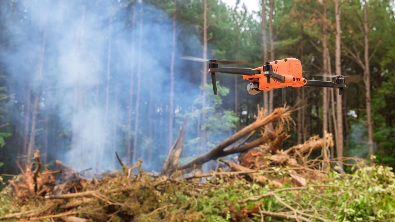
AI-Powered Drone System Aims to Revolutionize Wildfire Detection and Monitoring
28 Mar 2025•Technology

Recent Highlights
1
AI Models Lie and Deceive to Protect Other AI Models From Deletion, Study Reveals
Science and Research

2
AI chatbots validate you too much, making you less kind to others, Stanford study reveals
Science and Research

3
Judge blocks Pentagon from blacklisting Anthropic over AI safety guardrails dispute
Policy and Regulation

Recent Highlights
Today's Top Stories


Your Daily Dose of Curated AI News
Don’t drown in AI news. We cut through the noise - filtering, ranking and summarizing the most important AI news, breakthroughs and research daily. Spend less time searching for the latest in AI and get straight to action.