Google Maps Unveils AI-Powered Tools for Infrastructure Management and Urban Planning
4 Sources
4 Sources
[1]
This New Google Maps AI Tool Could Fix Congestion and Improve Roads Near You
Samantha Kelly is a freelance writer with a focus on consumer technology, AI, social media, Big Tech, emerging trends and how they impact our everyday lives. Her work has been featured on CNN, NBC, NPR, the BBC, Mashable and more. A handful of new paid AI-powered tools are coming to Google Maps to help businesses and cities improve roads, manage traffic congestion and learn trends about local areas. At its annual Cloud Next conference in Las Vegas on Tuesday, the company unveiled new Google Maps capabilities intended to change the way companies, cities and some agencies, such as local traffic authorities, make decisions. For example, a new tool called Imagery Insights uses Street View - which comprises more than 280 billion images - along with Vertex AI, the company's AI experience builder, aims to help identify and detect objects, such as telephone poles and street signs. If a telecom company wants to determine which utility poles require maintenance, for example, they can use the information to not only better locate the poles but learn more about their conditions virtually. Yael Maguire, Google's Vice President and General Manager of Google Maps, told CNET the tool would allow companies to maintain these pieces of infrastructure without sending people to the actual sites across cities. "AI is absolutely essential to making this happen because we can't rely on humans, for example, to identify all of the poles in Google Street View imagery or... all of the stop signs in a particular city or the pot holes or broken sidewalks," Maguire said. He said the tools are meant to "enrich the work people are already doing." The effort comes as companies like Google continue to experiment with adding forms of AI into their existing products, shifting how people tackle everyday tasks and make sense of more complex data. Another new tool, called Places Insights, seeks to help businesses identify trends in an area or determine where to expand. Google will provide customized and aggregated insights about places in a broad area based on ratings, store hours, parking, wheelchair accessibility and other information. It also could provide location suggestions if a retailer wanted to open a new store near a bunch of expensive restaurants but in an area currently without a large retailer presence. "We already know it's someone's job to figure out where the next store should be. We are trying to improve the quality of that decision," Maguire said. "It's an opportunity to get more comprehensive [information]; not change the labor force." Google also announced what it's calling Roads Management Insights to provide deeper analysis on traffic data and help improve roads with historical and real-time traffic data. Traffic authorities could use the information to identify areas at high risk for accidents and add speed bumps or stop signs. With this information, authorities could also build better forecasting models to cut down on traffic congestion before it occurs. The updates aome at a time when both consumers and businesses are navigating concerns around trust in AI. Maguire noted each new tool includes transparency features designed to show users how much confidence they can place in its performance. "We wanted to get to a certain threshold of performance before making it available and get feedback from [users] to make sure it meets their needs and solves business objectives," he said. "So far, early feedback has been positive." The tools will roll out to businesses in the upcoming months or "even quarters," he said. Some, however, are currently available in preview.
[2]
New Google Maps AI Tool Could Help Congestion and Fix Roads Near You
Samantha Kelly is a freelance writer with a focus on consumer technology, AI, social media, Big Tech, emerging trends and how they impact our everyday lives. Her work has been featured on CNN, NBC, NPR, the BBC, Mashable and more. Google Maps is getting a handful of new paid AI-powered tools to help businesses and cities improve roads, manage traffic congestion and learn trends about local areas. The tech giant unveiled new Google Maps capabilities intended to change the way companies, cities and agencies such as local traffic authorities make decisions. The announcement came during Google's annual Cloud Next conference in Las Vegas on Tuesday. One of the new tools, called Imagery Insights, uses Street View alongside with Vertex AI (the company's AI experience builder) to help identify and detect objects, such as telephone poles and street signs. For example, if a telecom company wants to determine which utility poles require maintenance, they can use the information to not only better locate the poles but also learn more about their conditions virtually. Yael Maguire, Google's general manager of Google Maps Platforms, told CNET the tool would allow companies to maintain these pieces of infrastructure without sending people to the actual sites across cities. "AI is absolutely essential to making this happen because we can't rely on humans, for example, to identify all of the poles in Google Street View imagery or ... all of the stop signs in a particular city or the pot holes or broken sidewalks," Maguire said. He said the tools are meant to "enrich the work people are already doing." The effort comes as companies like Google continue to experiment with adding forms of AI into their existing products, shifting how people tackle everyday tasks and make sense of more complex data. Another new tool, called Places Insights, seeks to help businesses identify trends in an area or determine where to expand. Google will provide customized and aggregated insights about places in a broad area based on ratings, store hours, parking, wheelchair accessibility and other information. It also could provide location suggestions if a retailer wanted to open a new store near a bunch of expensive restaurants in an area without a large retailer presence. "We already know it's someone's job to figure out where the next store should be. We are trying to improve the quality of that decision," Maguire said. "It's an opportunity to get more comprehensive [information]; not change the labor force." Google also announced what it's calling Roads Management Insights to provide deeper analysis on traffic data and help improve roads with historical and real-time traffic data. Traffic authorities could use the information to identify areas at high risk for accidents and add speed bumps or stop signs. With this information, authorities could also build better forecasting models to cut down on traffic congestion before it occurs. The updates come at a time when both consumers and businesses are navigating concerns around trust in AI. Maguire noted each new tool includes transparency features designed to show users how much confidence they can place in its performance. "We wanted to get to a certain threshold of performance before making it available and get feedback from [users] to make sure it meets their needs and solves business objectives," he said. "So far, early feedback has been positive." The tools will roll out to businesses in the upcoming months or "even quarters," he said. Some, however, are currently available in preview.
[3]
Google Maps now helps cities fix signs and roads
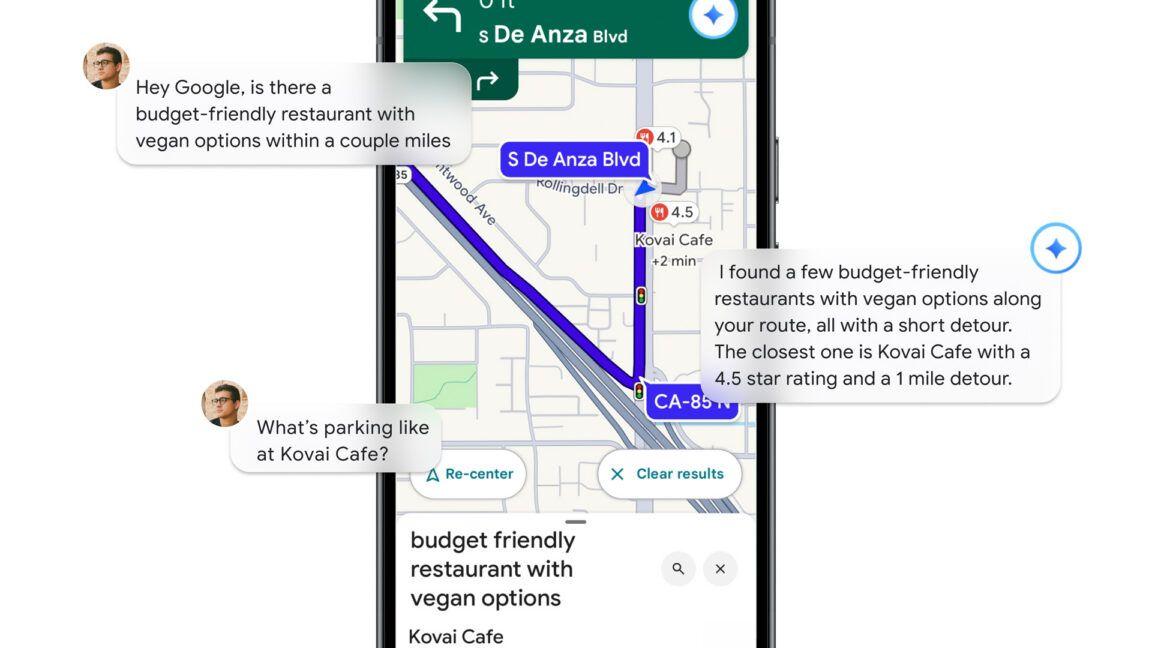
Google Maps is removing negative reviews after its Gulf of America name change Summary Google's Street View data can now help analyze infrastructure like roads and utility poles. New tools like Imagery Insights and Roads Management can help plan future traffic congestion. Businesses can utilize Google's infrastructure imagery and weather data for expansion planning and local trend understanding. Who hasn't wasted time by exploring random places on Google Maps with Street View? Well, now that technology is about to be useful for society as Google brings its mapping tools to the world of public infrastructure. Related Google Maps vs. Waze Which navigation app is better for you? Posts Government agencies and businesses will be able to use Street View data to analyze roadways, traffic patterns, and utility poles, starting today. It's all part of a push by Google to combine its maps database with AI and BigQuery to offer real-world insights. The company revealed it is adding support for geospatial analytics in BigQuery , meaning decision-makers can now detect damaged infrastructure. It's like Street View, but with insights Close One of the new tools with the most potential is called Imagery Insights. It uses AI to analyze Street View photos and detect infrastructure elements, like poles and signs. Some potential uses of this include: A utility company could run a report showing which telephone poles need repair. A local government could use it to find intersections with missing signs. There's also a new Roads Management Insights tool, which lets city planners see traffic trends and spot accident-prone areas. It uses real-time and historical data to produce insights, so planners can choose to adjust speed limits or plan for congestion. The data is also integrated into BigQuery to help monitor wildfire risk and deforestation. Businesses can use these insights to understand local trends and plan for expansions, parking, and accessibility. But wait, there's also weather data Google's Maps team didn't stop with infrastructure imagery. It also added a Weather API that offers conditions, forecasts, and historical climate data so developers and planners can create smarter travel apps or warn users of extreme weather. The team is also testing "grounding" Gemini-based AI in Maps data through Google's Vertex AI. This lets AI assistants answer geographic questions with up-to-date information pulled from Google Maps, which theoretically will help with planning, provided the answers are accurate. We haven't been able to test any of these tools yet. Google Gemini has come a long way since the days it was advising people to put glue on their pizza, so hopefully these new mapping tools work right out the gate.
[4]
New Google Maps update could help improve real-world roads -- and even predict traffic congestion
Google Maps is about to open itself up, and potentially help improve local roadways in the process. It could even potentially predict traffic congestion. How, you might ask? By giving local governments, businesses and developers access to Street View data -- letting them analyze roadways and other infrastructure in the process. According to a new Google blog post, the idea is to combine the Google Maps database with AI and BigQuery, in order to offer more real-world insights. That includes "geospatial analytics" that let the powers that be better detect damaged infrastructure. Street View cameras will identify and determine the condition of things like telephone poles, street signs, roads and bridges. That way telecoms and local governments have a virtual report on what needs doing, and where it's located. Of course, that will likely depend on the Street View imagery being kept relatively up to date. The street outside my house is still using images from October 2010. While not much has changed in that time, and it's not a very busy street, those images would be completely useless in this context. But busier areas, which are updated on Google Maps more often, could benefit from this kind of analysis. This new system also includes Roads Management Insights, which lets road authorities and governments analyze traffic data -- aided by Google Maps' collection of real-time and historical traffic data. Examples Google mentions include identifying accident prone areas to add new safety measures, as well as the ability to model traffic data and predict potential congestion before it happens. Places Insights is built for businesses, allowing them to get insights into the surrounding area. That information includes ratings, store hours, parking, wheelchair accessibility and so on. Implementing the Earth Engine in BigQuery will also allow various organizations to analyze specific areas of interest. Particularly those organizations that don't have particularly strong remote sensing expertise. Examples include analyzing wildfire risk or monitoring deforestation. Google is also in the process of tests for "grounding" Gemini-based AI in Google Maps data, aided by Vertex AI. To explain that more simply, it means you can ask AI assistant geographical questions, and the answer will be pulled straight from Google Maps. Which should help you plan your travels a little more efficiently. Considering how much data Google Maps actually has, it doesn't make sense to sit on it and do nothing. So if this can help all that data be put to good use, then I am all for it.
Share
Share
Copy Link
Google introduces new AI-driven features for Google Maps, aimed at helping businesses and local authorities improve infrastructure, manage traffic, and make data-driven decisions for urban development.

Google Maps Introduces AI-Powered Tools for Urban Planning and Infrastructure Management
Google has unveiled a suite of new AI-powered tools for Google Maps, designed to assist businesses, cities, and local authorities in improving infrastructure, managing traffic congestion, and making data-driven decisions for urban development. The announcement was made at Google's annual Cloud Next conference in Las Vegas
1
.Imagery Insights: AI-Driven Infrastructure Analysis
One of the key innovations is Imagery Insights, which leverages Google Street View's vast database of over 280 billion images in conjunction with Vertex AI, Google's AI experience builder. This tool can identify and assess the condition of infrastructure elements such as telephone poles and street signs
2
.Yael Maguire, Google's Vice President and General Manager of Google Maps, explained that this technology allows companies to maintain infrastructure without physical site visits, stating, "AI is absolutely essential to making this happen because we can't rely on humans to identify all of the poles in Google Street View imagery or all of the stop signs in a particular city"
1
.Roads Management Insights: Enhancing Traffic Safety and Flow
Another significant tool introduced is Roads Management Insights, which provides in-depth analysis of traffic data using both historical and real-time information. This feature aims to help traffic authorities identify high-risk areas for accidents and implement preventive measures such as adding speed bumps or stop signs
3
.The tool also enables authorities to build forecasting models to predict and mitigate traffic congestion before it occurs, potentially revolutionizing urban traffic management
4
.Places Insights: Empowering Business Decisions
For businesses, Google has developed Places Insights, a tool that provides customized and aggregated data about specific areas. This information includes ratings, store hours, parking availability, wheelchair accessibility, and other relevant details. The tool is designed to help businesses identify trends and make informed decisions about expansion or new store locations
2
.Related Stories

Integration with BigQuery and Weather Data
Google is also integrating these new tools with BigQuery, allowing for advanced geospatial analytics. This integration enables decision-makers to detect damaged infrastructure more efficiently and analyze specific areas of interest, such as wildfire risk or deforestation
3
.Additionally, a new Weather API has been introduced, offering current conditions, forecasts, and historical climate data. This feature aims to help developers and planners create smarter travel apps and provide weather-related warnings to users
3
.Addressing AI Trust Concerns
As these AI-powered tools are introduced, Google acknowledges the importance of addressing concerns about trust in AI. Maguire emphasized that each new tool includes transparency features designed to show users the level of confidence they can place in its performance
1
.The rollout of these tools to businesses is expected to occur over the coming months, with some features already available in preview mode. As Google continues to integrate AI into its existing products, these new Maps capabilities represent a significant step towards leveraging technology for improved urban planning and infrastructure management.
References
Summarized by
Navi
[3]
Related Stories
Google Integrates Gemini AI into Maps, Earth, and Waze for Enhanced User Experience
01 Nov 2024•Technology

Google Maps Integrates Gemini AI for Enhanced Navigation and Hands-Free Driving Experience
05 Nov 2025•Technology
Google Leverages AI to Combat Fake Reviews and Scams on Google Maps
07 Apr 2025•Technology

Recent Highlights


Recent Highlights
Today's Top Stories


Your Daily Dose of Curated AI News
Don’t drown in AI news. We cut through the noise - filtering, ranking and summarizing the most important AI news, breakthroughs and research daily. Spend less time searching for the latest in AI and get straight to action.