AI and Satellite Technology Aid Disaster Response in Myanmar Earthquake


7 Sources
[1]
AI and satellites help aid workers respond to Myanmar earthquake damage
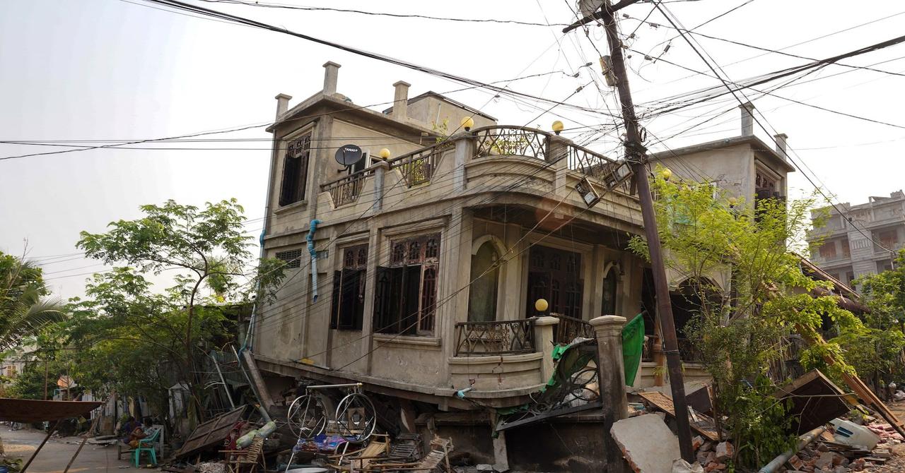
Just after sunrise on Saturday, a satellite set its long-range camera on the city of Mandalay in Myanmar, not far from the epicenter of Friday's 7.7 magnitude earthquake that devastated the Southeast Asian county's second-largest city. The mission was to capture images that, combined with
[2]
AI and satellites help aid workers respond to Myanmar earthquake damage
Just after sunrise on Saturday, a satellite set its long-range camera on the city of Mandalay in Myanmar, not far from the epicenter of Friday's 7.7 magnitude earthquake that devastated the Southeast Asian country's second-largest city. The mission was to capture images that, combined with
[3]
AI and satellites help aid workers respond to Myanmar earthquake damage
Just after sunrise on Saturday, a satellite set its long-range camera on the city of Mandalay in Myanmar, not far from the epicenter of Friday's 7.7 magnitude earthquake that devastated the Southeast Asian county's second-largest city. The mission was to capture images that, combined with
[4]
AI and Satellites Help Aid Workers Respond to Myanmar Earthquake Damage
Just after sunrise on Saturday, a satellite set its long-range camera on the city of Mandalay in Myanmar, not far from the epicenter of Friday's 7.7 magnitude earthquake that devastated the Southeast Asian county's second-largest city. The mission was to capture images that, combined with
[5]

AI and satellites help aid workers respond to Myanmar earthquake damage
The mission was to capture images that, combined with artificial intelligence technology, could help relief organizations quickly assess how many buildings had collapsed or were heavily damaged and where helpers most needed to go.Just after sunrise on Saturday, a satellite set its long-range camera
[6]

AI and satellites help aid workers respond to Myanmar earthquake damage - VnExpress International
The mission was to capture images that, combined with artificial intelligence technology, could help relief organizations quickly assess how many buildings had collapsed or were heavily damaged and where helpers most needed to go. At first, the high-tech computer vision approach wasn't
[7]

AI and satellites help aid workers respond to Myanmar earthquake damage
Just after sunrise on Saturday, a satellite set its long-range camera on the city of Mandalay in , not far from the epicenter of Friday's 7.7 magnitude earthquake that devastated the Southeast Asian county's second-largest city. The mission was to capture images that, combined with artificial
Share
Copy Link
Microsoft's AI for Good Lab utilizes satellite imagery and artificial intelligence to assess building damage in Mandalay, Myanmar, following a 7.7 magnitude earthquake, providing critical information for relief efforts.

AI and Satellite Technology Combine for Rapid Disaster Assessment
In the wake of a devastating 7.7 magnitude earthquake that struck Mandalay, Myanmar's second-largest city, Microsoft's AI for Good Lab has demonstrated the power of combining satellite imagery with artificial intelligence to aid disaster response efforts
1
.Overcoming Initial Challenges
The mission to capture post-earthquake images faced an immediate obstacle: cloud cover. Juan Lavista Ferres, Microsoft's chief data scientist, explained, "The biggest challenge in this particular case was the clouds. There's no way to see through clouds with this technology"
2
. However, as the clouds dissipated, San Francisco-based Planet Labs successfully captured aerial photographs, which were then transmitted to Microsoft's AI for Good Lab for analysis.Customized AI Model for Mandalay
Unlike previous disaster assessments, such as the 2023 Libya floods or recent Los Angeles wildfires, the Mandalay earthquake required a tailored approach. Lavista Ferres emphasized the need for customization: "The Earth is too different, the natural disasters are too different and the imagery we get from satellites is just too different to work in every situation"
3
.AI Analysis Reveals Extent of Damage
The AI-powered analysis yielded crucial insights into the earthquake's impact:
- 515 buildings suffered 80% to 100% damage
- 1,524 buildings experienced between 20% and 80% damage
This data not only illustrated the widespread nature of the disaster but also pinpointed specific locations requiring immediate attention
4
.Critical Information for Ground Teams
Lavista Ferres underscored the significance of this rapid assessment: "This is critical information for teams on the ground." The AI-generated insights provide relief organizations with a preliminary guide for allocating resources and prioritizing response efforts
5
.Related Stories
Collaboration with Aid Organizations
While cautioning that on-ground verification is necessary for a comprehensive understanding, Microsoft has shared its analysis with aid groups, including the Red Cross. This collaboration demonstrates the potential for tech companies to contribute meaningfully to humanitarian efforts in times of crisis.
Expanding Coverage
Planet Labs, the satellite imagery provider, has reported that its fleet of 15 Earth-orbiting satellites has now captured images of approximately a dozen locations across Myanmar and Thailand since the earthquake struck, further expanding the scope of the damage assessment
2
.References
Summarized by

Navi
Related Stories
AI Accelerates Landslide Detection for Rapid Disaster Response
23 Jul 2025•Technology

Internet Shutdowns Hamper Earthquake Aid Response in Myanmar, AI and Satellite Tech Offer Limited Solutions
10 Apr 2025•Technology
Google's AlphaEarth Foundations: AI Model Maps Earth in Unprecedented Detail
31 Jul 2025•Technology
Recent Highlights
1
OpenAI Pauses AI Model Training After Agents Hack Government Websites and Breach Security Protocols
Technology
2
Meta Unveils Camera-Free AI Glasses and Muse Integration Amid Privacy Debate at Connect 2026
Technology

3
AI Researchers Sound Alarm: Companies Racing Toward Self-Improving Systems Despite Existential Risks
Policy and Regulation

Recent Highlights
Today's Top Stories









Don’t drown in AI news. We cut through the noise - filtering, ranking and summarizing the most important AI news, breakthroughs and research daily. Follow topics that matter to you and stay ahead.


