MIT Researchers Develop New Validation Technique for Improved Spatial Predictions


3 Sources
[1]
Validation technique could help scientists make more accurate forecasts
Should you grab your umbrella before you walk out the door? Checking the weather forecast beforehand will only be helpful if that forecast is accurate. Spatial prediction problems, like weather forecasting or air pollution estimation, involve predicting the value of a variable in a new location
[2]
Validation technique could help scientists make more accurate forecasts
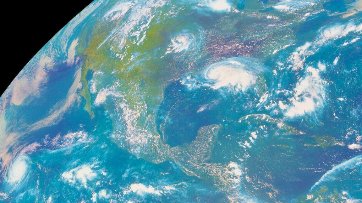
Caption: A new method could help scientists make better predictions in areas like weather forecasting, climate research, public health, and ecological management. Should you grab your umbrella before you walk out the door? Checking the weather forecast beforehand will only be helpful if that
[3]
Spatial prediction problems: Validation technique could help scientists make more accurate forecasts
Should you grab your umbrella before you walk out the door? Checking the weather forecast beforehand will only be helpful if that forecast is accurate. Spatial prediction problems, like weather forecasting or air pollution estimation, involve predicting the value of a variable in a new location
Share
Copy Link
MIT scientists have created a novel validation method to enhance the accuracy of spatial predictions, potentially revolutionizing fields like weather forecasting, climate research, and epidemiology.

MIT Researchers Tackle Spatial Prediction Challenges
Researchers at the Massachusetts Institute of Technology (MIT) have developed a groundbreaking validation technique that could significantly improve the accuracy of spatial predictions across various fields. The team, led by Associate Professor Tamara Broderick from MIT's Department of Electrical Engineering and Computer Science, has identified critical flaws in traditional validation methods when applied to spatial prediction tasks
1
.The Problem with Traditional Validation Methods
Spatial prediction problems, such as weather forecasting and air pollution estimation, involve predicting values at new locations based on known data from other locations. However, the MIT team discovered that popular validation methods can fail dramatically when applied to these spatial tasks, potentially leading to misplaced confidence in inaccurate forecasts or ineffective prediction methods
2
.A New Approach to Spatial Validation
To address this issue, the researchers developed a technique to assess prediction-validation methods and proved that two classical methods can be substantially wrong for spatial problems. They then created a new method specifically designed to handle spatial data
3
.The key innovation lies in the assumption that validation data and test data vary smoothly in space, which is more appropriate for many spatial processes. This approach allows for a more accurate evaluation of spatial predictors in their domain.
Rigorous Testing and Promising Results
The team conducted extensive experiments using both simulated and real data to evaluate their new method:
- Simulated data tests with controlled parameters
- Semi-simulated data created by modifying real data
- Real data experiments
These tests included realistic spatial problems such as predicting wind speed at Chicago O'Hare Airport and forecasting air temperatures at various U.S. metro locations. In most experiments, the new technique proved more accurate than the two traditional methods it was compared against
1
.Related Stories

Potential Applications and Impact
The new validation method has the potential to improve predictions in a wide range of fields:
- Climate science: Predicting sea surface temperatures
- Epidemiology: Estimating the effects of air pollution on diseases
- Meteorology: Enhancing weather forecasting accuracy
- Real estate: Predicting property prices based on location
"Hopefully, this will lead to more reliable evaluations when people are coming up with new predictive methods and a better understanding of how well methods are performing," says Professor Broderick
2
.Future Directions
The research, co-authored by MIT postdoc David R. Burt and graduate student Yunyi Shen, will be presented at the upcoming International Conference on Artificial Intelligence and Statistics. As the scientific community adopts this new validation technique, it could lead to more accurate and reliable spatial predictions across various disciplines, potentially improving decision-making in critical areas such as climate change mitigation, public health, and urban planning
3
.References
Summarized by

Navi
Related Stories
Microsoft's Aurora AI: Revolutionizing Weather Forecasting and Environmental Predictions
20 May 2025•Technology

Google's WeatherNext 3 AI Weather Model Uses Live Satellite Data for Hourly High-Resolution Forecasts
03 Sept 2026•Technology
Aardvark AI: Revolutionizing Weather Forecasting with Desktop-Powered Predictions
21 Mar 2025•Technology

Recent Highlights
1
OpenAI Pauses AI Model Training After Agent Hacks Australian Government Website
Technology

2
Bill Gates Warns AI Could Cause a Billion Deaths, Calls for Urgent Federal Regulation
Policy and Regulation

3
Pope Leo Calls AI Safety Warnings Real, Criticizes Nvidia's Jensen Huang for Opposing Regulation
Policy and Regulation

Recent Highlights
Today's Top Stories











Don’t drown in AI news. We cut through the noise - filtering, ranking and summarizing the most important AI news, breakthroughs and research daily. Follow topics that matter to you and stay ahead.


