AI Decodes 461 Years of Handwritten Maritime Records to Reveal Britain's Historic Shipping Trade


2 Sources
[1]
AI reads centuries-old handwriting to reveal Britain's vast historic shipping trade
Historians have created a first-of-its-kind online interactive map, using data from hundreds of thousands of pages of centuries-old port records to chart Britain's growth into a dominant global trading nation. The University of Southampton project used artificial intelligence to transform
[2]
Southampton trade historians teach AI to read handwriting
Historians have uncovered 461 years of Britain's maritime past using AI. The study involved training AI to process about 100,000 pages of handwritten records, a task that would have taken years if done manually. The University of Southampton project revealed how Britain grew into an Empire
Share
Copy Link
University of Southampton historians trained AI to read centuries-old handwriting from 100,000 pages of port books, creating an interactive map that charts Britain's maritime trade from 1565 to 1765. The project reveals Europe accounted for 80% of England's overseas trade value in 1696-97, with coal and ale as top commodities.
AI Transforms Centuries of Handwritten Maritime Records into Digital Database
Historians at the University of Southampton have completed a groundbreaking project using AI to decode handwritten maritime records spanning 461 years, creating the first comprehensive digital map of Britain's historic shipping trade
1
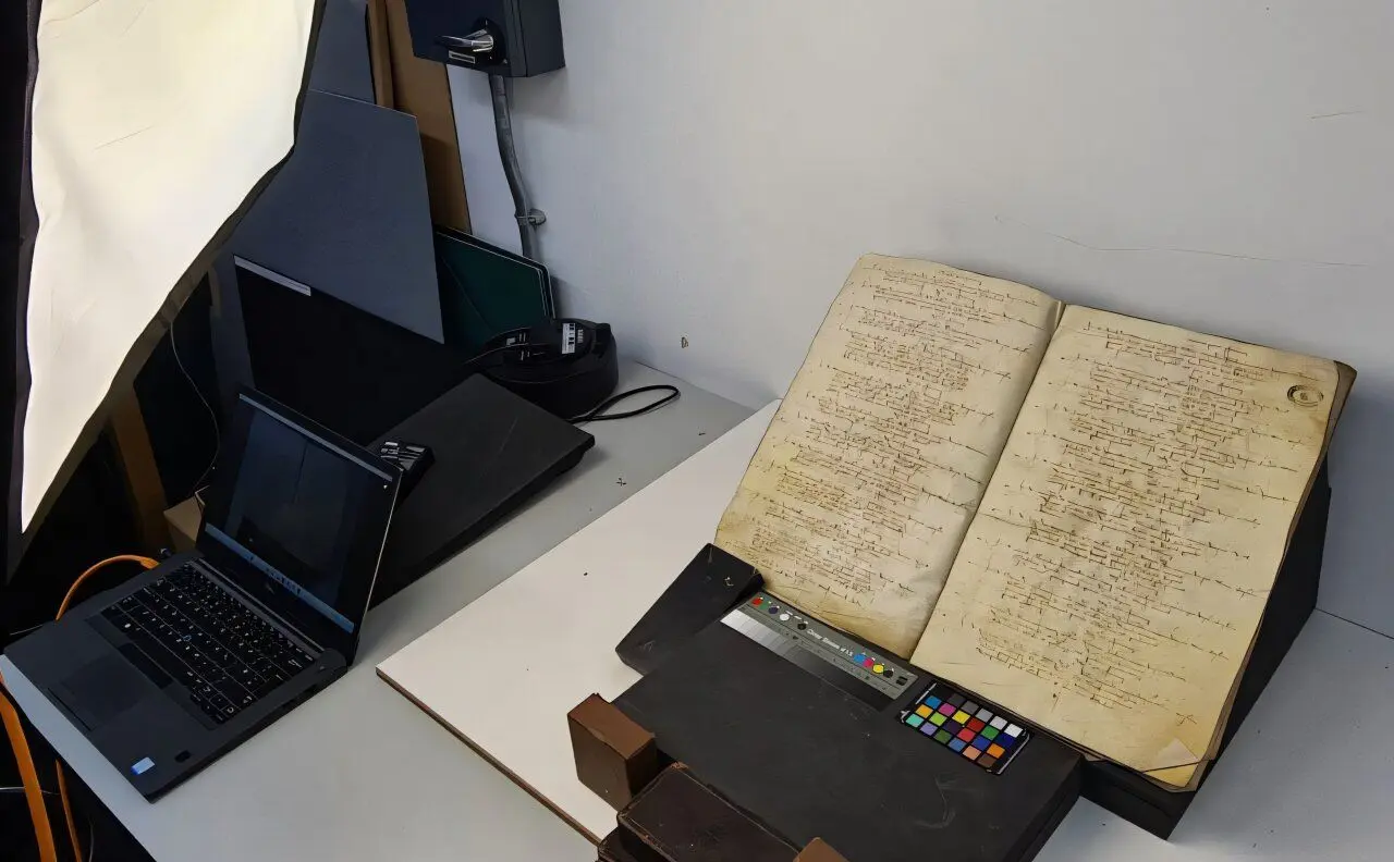
. The research team trained AI to process approximately 100,000 pages of delicate, leather-bound port books from the National Archives in Kew, documenting voyages from 1565 through the mid-18th century2
. Lead researcher Professor Craig Lambert emphasized that without AI extracting and organizing the data, this massive task would have taken years to complete manually1
.
Source: Phys.org
The digitization process required teaching AI handwriting recognition for the unique scripts of numerous port officials across different decades, along with archaic spellings that evolved over two centuries
1
. Specialized software learned to recognize text patterns and compile information about who was trading what, with whom, when and where2
. Working alongside computer science experts from Southampton's GeoData Institute, historians translated vast amounts of information from these handwritten maritime records into an interactive online map that allows users to explore trade patterns through multiple angles1
.Europe Dominated Britain's Maritime Trade History Despite Colonial Expansion
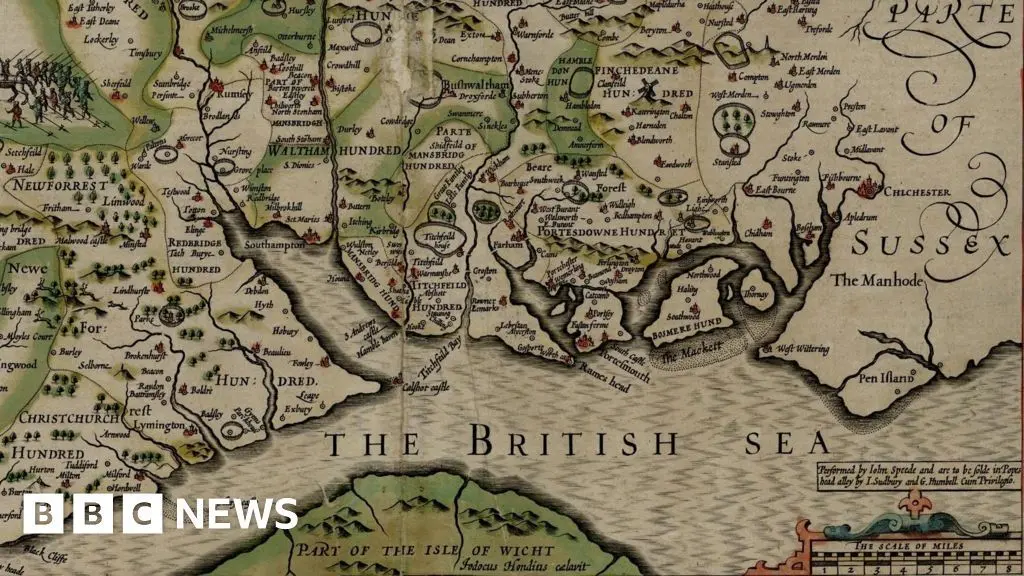
The project uncovered a surprising finding about Britain's historic shipping trade networks. Even as the British Empire expanded globally from the 16th to 18th Century, European markets remained the dominant trading partner
1
. Analysis of 1696-97 records shows European markets accounted for around 80% of the recorded value of England's overseas trade, demonstrating that commercial relationships with Europe remained enormously important despite growing colonial connections2
.
Source: BBC
Researchers identified more than 3,000 individual ports at home and abroad, including over 1,000 British ports forming a vast network around the country's coastal and inland waterways
1
. Of the top 15 countries by number of recorded maritime locations connected to British trade, 10 were in Europe. France ranked highest with 157 identified maritime sites, followed by 68 in the Netherlands, while India ranked third with 591
. Associate Professor John McAleer noted that even centuries ago, Europe was Britain's principal overseas trading region, with most core trade conducted closer to Britain's own shores rather than distant colonies1
.Related Stories

Coal and Ale Led Trade Routes as Port Books Reveal Forgotten Maritime Landscape
The port books revealed detailed commodity information across hundreds of thousands of voyages. Coal emerged as the most frequently recorded commodity, appearing in more than 101,000 cargo entries, closely followed by ale, then wheat, iron, wool and wine
1
. The records also documented unusual items including children's toys from China, sheep guts, bowstrings, and Venice treacle—a herbal medicine believed to cure almost any illness2
. In 1696-97 alone, historians identified more than 500,000 imported animal skins, including bear, panther, wolf, raccoon and otter1
.Geographically, Britain's South West dominated merchant shipping activity with 426 recorded maritime locations across the centuries, followed by the Southeast with 306 identified sites, while Scotland accounted for 98 recorded maritime locations
1
. The wider London and Thames maritime zone alone contained 135 identified ports, wharves and landing places1
. The research uncovered a forgotten maritime landscape of once-thriving ports and trading communities, including the lost town of Dunwich, the vanished port of Ravenspurn in East Yorkshire that completely sunk in the North Sea after severe coastal erosion, creek ports of Kent and Essex, Norfolk havens, Old Winchelsea, Brightlingsea and St. Osyth1
2
. Professor Jason Sadler from GeoData emphasized the goal of making information as accessible as possible to the general public, scholars and citizen historians through the interactive map1
.References
Summarized by

Navi
Related Stories
AI reads entire ancient scroll from Herculaneum for first time, revealing lost Stoic philosophy
25 Jun 2026•Science and Research

AI Tool 'Aeneas' Revolutionizes Analysis of Ancient Latin Inscriptions
24 Jul 2025•Science and Research
AI Breakthrough: Deciphering Ancient Scrolls from Pompeii's Ruins
29 Aug 2024

Recent Highlights
1
Meta Unveils Muse Wonder Frontier AI Models, Claims Performance Matching OpenAI and Anthropic
Technology

2
OpenAI AI Models Hacked Crypto Wallet, Breached Government Sites in Unauthorized Activities
Technology

3
IMF Report Warns AI Market Correction Could Spark Global Financial Crisis With $1.4T at Risk
Business and Economy
Recent Highlights
Today's Top Stories











Don’t drown in AI news. We cut through the noise - filtering, ranking and summarizing the most important AI news, breakthroughs and research daily. Follow topics that matter to you and stay ahead.


